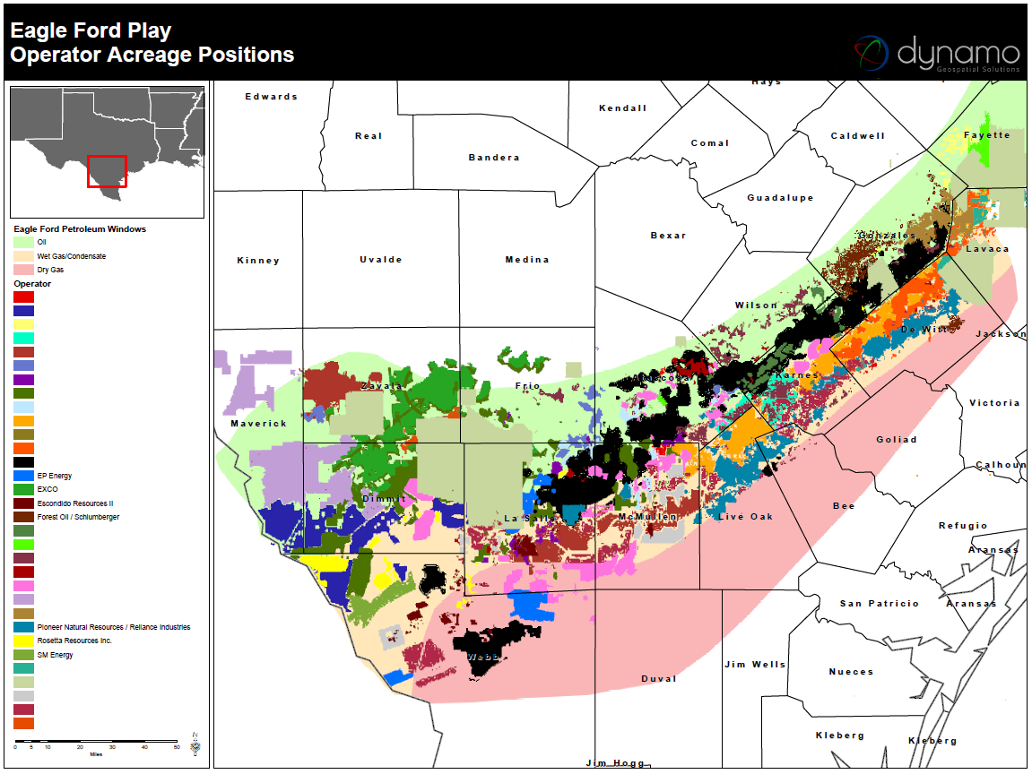
Dynamo Spatial Parcel Data Logo
Home About Parcels Services Oil/Gas Maps Features Contact

Eagle Ford Shale

The Eagle Ford Shale is a hydrocarbon producing formation of significant importance due to its capability of producing both gas and more oil than other traditional shale plays. It contains a much higher carbonate shale percentage, upwards to 70% in south Texas, and becomes shallower and the shale content increases as it moves to the northwest. The high percentage of carbonate makes it more brittle and “fracable”. The Eagle Ford Shale play trends across Texas from the Mexican border up into East Texas, roughly 50 miles wide and 400 miles long with an average thickness of 250 feet. more...

View More Lease Acreage Maps

Counties contained in Eagle Ford Shale:

Atascosa, TX
Bee, TX
Brazos, TX
Burleson, TX
DeWitt, TX
Dimmit, TX
Fayette, TX
Frio, TX
Gonzales, TX
Karnes, TX
La Salle, TX
Lavaca, TX
Lee, TX
Leon, TX
Live Oak, TX
Madison, TX
Maverick, TX
McMullen, TX
Milam, TX
Robertson, TX
Walker, TX
Webb, TX
Wilson, TX
Zavala, TX

Major operators active in Eagle Ford Shale:

Abraxas Petroleum Corp.

Anadarko Petroleum Corporation

Argent Energy Trust

Aurora Oil & Gas Ltd.

BHP Billiton Limited

Cabot Oil & Gas Corporation

Carrizo Oil & Gas Inc.

Chesapeake Energy Corporation

Clayton Williams Energy Inc.

Comstock Resources Inc.

ConocoPhillips

Crimson Exploration Inc.

Devon Energy Corporation

EOG Resources, Inc.

EP Energy Corporation

Escondido Resources Ii, Llc

Exco Resources Inc.

Freeport-Mcmoran Inc.

Georesources, Inc.

Marathon Oil Corporation

Matador Resources Company

Murphy Oil Corporation

Newfield Exploration Co.

Penn Virginia Corporation

Pioneer Natural Resources Co.

Rosetta Resources, Inc.

Sabine Oil & Gas Corporation

Sanchez Energy Corporation

Schlumberger Limited

SM Energy Company

Swift Energy Co.

Talisman Energy Inc.

US Energy Corp.

See maps for other major oil and gas plays

Dynamo Spatial, LLC.

Copyright 2025