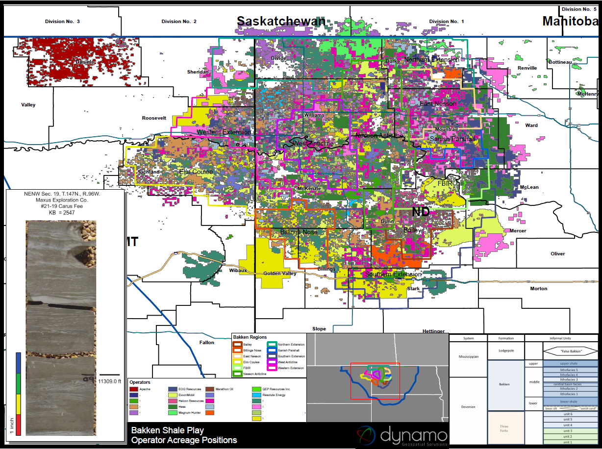
Bakken Shale & Three Forks
The Bakken Shale formation covers approximately 200,000 square miles. The Williston Basin has high well costs, difficult weather conditions, and insufficient pipeline capacity. Both the middle Bakken Shale and upper Three Forks are deep, which increases costs. more...